modRana
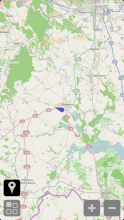
modRana is a flexible GPS navigation system for mobile Linux devices.
Currently supported features @ Sailfish:
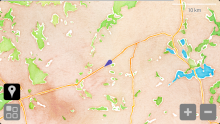
- showing current position and direction of travel on the map
- map tile caching (each tile is downloaded only once)
- fast and robust tile loading and downloading
- persistent map overlay support
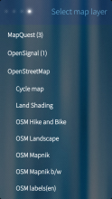
- a great lot of various map layers
- support for OSM Scout Server
- supported features:
- map layers (day & night)
- place search
- local search
- routing
- how to run OSM Scout Server on your device see:
- supported features:
- simple yet powerful point to point routing support
- long click a point on the map for quick routing
- turn by turn navigation support
- press the navigate button to start navigation
- built-in POI database - store any points and look them up later! :)
- store points from map or search results
- use stored POIs as local search location
- supports both landscapes and both portraits
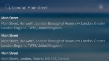
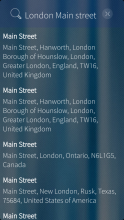
- address search, powered Nominatim and based on OpenStreeMap data
- this is not strictly address search, queries such as "london tesco" will find all Tescos in London
- you can also search for restaurants and other amenities with unique names, such as "Delirium cafe", which will find the venue of the annual FOSDEM beer event
- Wikipedia search
- local search
- search for various amenities around your current location
- generic keywords such as "pizza", "food", "pub", "restaurant" or "WC" work
- searching specific amenity names (restaurant, hotel names, etc.) also works
- search results are displayed as markers on the map
- track recording into the GPX format is supported
- can display GPX tracklogs on the map
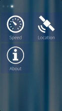
- page displaying current speed in nice friendly letters
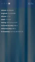
- detailed GPS info display
- keeps screen on by default
- you can use the volume rocker to zoom the map
- compass rose can be displayed on the map screen
- localized to many languages
- about page & donation links ;-)
Known issues
- some Options pages are empty
- compass rose not working on Sailfish X yet due to broken compass API
modRana is open source! :)
And all its source code is available on GitHub in the modRana source code repository. So if you can code and would like to contribute to modRana development, even with the smallest of patches, you are definitely welcome! :)
Additional resources:
- TMO discussion thread
- Maemo Wiki article
- modRana project homepage
- source code repository on Github - patches welcome ! :)
- localization project on Transifex - translators welcome! :)
Category:
Keywords:
Application versions:
Changelog:
0.57.3
- fix comptiblity issues with 3.3.0.x Rokua
- updated translations
0.56.17
- fix broken native launcher detection causing graphical glitches on some devices
0.56.14
- fix compatibility with 3.0.2 Oulanka
- modRana can by now launcher easily from CLI by typing: harbour-modrana
- updated translations
0.55.20
- it is now possible to delete individual saved POI
- adding new POI from the map should now be more intuitive
- translation update
0.55.19
- don't ship PNG icons in Sailfish OS package (the package is now ~600 kB smaller)
0.55.18
- all icons are now SVG and thus resolution independent! :)
- it is now possible to easily clear things displayed on top of the map
- show distance on POI listings
- fix toggle highlight for centering icon
0.55.16
- show "Route here" option on all point & POI detail pages
- fix layout of search progress popup
0.55.15
- improved on-map button & button text sizing
0.55.12
- show distance to POI in POI detail page
0.55.10
- show distance from current position on point detail pages
- fix route/tracklog/trace glitching on screen rotation/window size change
0.55.7
- translation updates
0.55.2
- add localization support
0.55.1
- turn-by-turn navigation support in Qt 5 GUI
- local POI database is now available
- it's possible to save arbitrary points from map as POI
- POIs can be used as a routing destination
- very high DPI fixes (Sailfish X/Xperia X)
- use Valhalla routing by default with OSM Scout Server
- add car optimized OSM Scout tile layers (day & night)
- take current heading into account for Valhalla routing
- it is now possible to do local search around arbitrary point on the map
- use QtQuick Controls 2 as backend on Desktop & Android
- very preliminary espeak based turn-by-turn voice output
0.54.8
- fix map config parsing related crash
- fix OSM Scout Server local search
- fixed search in progress indicator
- improved & clickable POI makers
- POI details are displayed on click
0.54.7
- properly wait for OSM Scout Server to finish rendering offline rendered tiles
0.54.5
- it is now possible to set opacity for routes, tracklogs and the logging trace
0.54.4
- fix map layer switching
- fix layer opacity setting
- sort POI search results by distance
- notification popups should now rotate correctly on Sailfish OS
- clear on-map long-press menu when map is clicked
- fix map canvas debug option not being persistent
- note which POI search methods are online and which can work with on-device data
- log PyOtherSide version during startup
- log how long it took to find a route
- fix returning of results for Monav-based offline routing
0.54.3
- fix places search not working
- try to fix map tiles not showing up on some 1080p devices
0.54.2
- OSM Scout Server can now be used for place search
- OSM Scout Server can now be used for local search
- OSM Scout Server can now be used for routing
0.54.1
- much better looking, more fluid & more optimized map display
- modRana should now look much better on high-DPI devices (Jolla C, Jolla Tablet, Intex Aquafish, etc.)
- a trace is now drawn on the map when recording a tracklog
- stored GPX tracklogs can be (finally!) displayed on the map
- map scaling has been fixed
0.53.5
- new more Sailfish OS like icon by Amboss - thanks a lot! :)
0.53.3
- add OSM Scout Server Day & Night map layers add OpenRailwayMap layers
- add OpenFireMap layers
- OpenTopoMap, Hike & Bike and Land/Hill Shading layers should now work again
- automatic tile download thread count now can be set in Qt 5 GUI
- tile download over HTTPS should now work better due to updated urllib3
0.53.2
- a minor tile overlay config loading fix
0.53.1
- map tile handling should be now much more robust
- issues with tiles not loading correctly on part of the screen should now be fixed
- tiles are now looked up with all supported storage methods (files & sqlite)
- Thunderforest map layers have been added
- some map layers that failed to display before should now show up properly
0.52.10
- you can now long click a point on the map for quick routing :)
- a route will be acquired from current position to the long-clicked point
0.52.9
- you might need to uninstall any previous modRana version to make updates to version >= 0.52.9 work
- fix compatibility with the modRana package in Jolla Store
- so that users can update modRana installed from Jolla Store with a newer version from OpenRepos or the other way around
- before this fix an update would be offered, but it would fail
0.52.1
- point to point online routing is now supported
- Frederik Ferner contributed the core Qt 5 GUI routing support code - thanks a lot! :-)
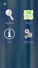
- routing mode can be activated from the main menu by clicking the Route button
- to end the routing mode, just press the clear button
- routing parameters can be configured in Options->Navigation
- you can now double-click the map to zoom in
- various statistics are now shown during track recording
- the CLI mode has been fixed
- media keys are now released when the modRana window is not active
- notifications now work correctly
0.51.2
- file tile loading from local storage and make it more robust
0.51.1
- track recording support
- accessible with Tracks->Record from the main menu
- recording should work fine even with screen turned off (enabled keep alive)
- there is a sqitch to enable a symlink from ~/Documents to the modRana tracklogs folder for enable easy access to the recorded tracklogs
- the resulting tracklog files are in the GPX format
0.50.5
- Sqlite tile storage now works correctly again :)
- make it possible to enable the back button in Options->UI
- fix the animation disable switch in Options->UI
0.50.2
- tiles are now automatically refreshed for danymic layers (traffic, weather, etc.)
- network usage modes can now be selected in Options->Network
- full mode - no network usage restrictions (default)
- minimal mode - don't automatically download map tiles
- Thanks a lot to Frederik Ferner for contributiong these two changes! :)
0.49.7
- the map screen compass rose should now show up properly
- last used base layer should now always be correctly restored on startup
0.49.6
- faster startup and startup progress indicator
- keep screen on by default
- can be disabled in Options->UI
- Bitcoin donation button has been fixed
- Gratipay donation button has been added
- average speed should now be displayed correctly
- debug log files can now be compressed
0.49.3
- a slightly transparent compass rose has been added to the upper left corner of the map screen
- you can turn it on/off and change its opacity in Options->UI
0.49.1
- the volume rocker can now be used for zooming the map
- you can now see the patch to the map data folder in Options->Map, together with ammount of free space for map data
- you can now enable the debug log file in Options->Debug and path to the log file is shown (if enabled)
0.48.2
- fix for crash on startup caused by a packaging mistake
0.48.1
- added support for persistent map overlays
- base layer and multiple overlays can be configured
- overlay opacity can be set
- the overlay configuration is persistent
- NOTE: more overlays mean more tile data downloaded and more work for the device when rendering tiles
- fix previous zoom level value not being restored on startup
- fix the the URL for the Map1.eu map layer
0.47.2
- added local search support
- current search results are now shown as markers on the map (currently selected result is red)
- search results are ordered by distance
0.47.1
- improved tile loading speed due to fully asynchronous tile downloading





Comments
silta
Tue, 2021/11/09 - 17:17
Permalink
Last version 0.57.3-1.1 is starting now on Xperia 10 II but doesn't find or display OSM ScoutServer maps, so I can't use it offline.
silta
Sat, 2021/06/12 - 10:51
Permalink
Hi Martin,
is there a version for aarch64 on the horizon? Unfortunately the current doesn't start on Xperia 10II.
Thanks in advance, silta.
ScumCoder
Sun, 2021/04/11 - 01:44
Permalink
Thanks for a great app, but I have to second nas's question: is it possible to set the default coordinates to somewhere besides Brno?
I fully support using your hometown as default city in your own software, but I still hope that it is not hardcoded onto C++ source :)
itsNotMe
Thu, 2020/07/30 - 15:09
Permalink
Hi Martin,
flashing a brand new Sailfish X Rokua and installing modrana again I see that Hike & Bike Map is not working. Looking into the log files I see only debug messages
mod.mapTiles: looking for tile
mod.storeTiles: tile requested:
mod.storeTiles: tile got stores: []
mod.storeTiles: tile not found:
mod.mapTiles: tile not found locally
mod.mapTiles: auto tile dl enabled - adding dl request for
but no
mod.storeTiles: store tile data for:
Cycle Map for instance is working and I see storing Message.
Do you have any hints to solve this?
Cheers
sdiconov
Tue, 2018/09/11 - 14:27
Permalink
Russian translation has been updated to include the new POI-related menus. Please, update the package.
nas
Tue, 2018/09/11 - 11:04
Permalink
Amaizing GPS/ map App! I use it on the road with car (thank you for the x4 Scaling option, very usefull on XperiaX and car), with overlay for traffic, but also on mountains and hiking, with Open street maps and keep a track log of my trip! A Reliable GPS App that just works! It saves the map in phone memory, so it keeps the the mobile traffic at low levels. I even go to the map of the mountain I will go, and follow the path in my house the area, with several map zoom levels, so I don't have to download it there, where it may not exist mobile network.
One thing that I noticed as I moved from Jolla1 to XperiaX, is that if there is not GPS signal at the moment the modRana starts, by default it goes every time at: 49.1..... , 16.6..... . Even if it had signal last time, and I was watching the map of my city.
I checked modRana's config files, and I didn't find anywhere a default value, so if it can't use the last saved GPS, or even the last position modRana had before closing it, I could set it manualy at my city, and be able to see traffic at the moment I run it, and not have to wait GPS signal or to go to point my street.
danfin
Mon, 2018/06/25 - 09:37
Permalink
silly questions:
a) is there a other way but setting route start and route end manually on the screen?
b) using OSM scout server, maps can not zoom in very far, the screen stays gray.
c) is it possible to load a externally generated .gpx files? How to load them?
MartinK
Mon, 2018/06/25 - 14:34
Permalink
a) In the latest modRana version you can route from current position to all search results & saved POI (just enter the point detail page & selecte the "route here" action from the pull down menu).
In the future a more comprehensive routing page is planned, where it will be possible to set (by address/from map/by coordinates/etc.) start, destination, any waypoints and other route parameters before requesting a route.
b) Seems to be working fine to me - I can zoom as far out that I see individual continents and as far in that I see street names. I suggest making sure your OSM Scout Server instance is running by launching it's control app manually - I have had some issues with it not auto-starting recently. Alternatively it could be that your offline mapping data could be out of date. ModRana does some chaching on the tiles generated by OSM Scout Server, which could mask OSM Scout Server not actually working & could explain what you are seeing (the gray tiles are tiles modRana has not cached before).
c) It is, it's just a bit cumbersome - just place your GPX file to:
/home/nemo/.local/share/harbour-modrana/tracklogs/logs
And it should show up in the modRana tracklog listing (you migt need to restart modRana for it to show up). Also in Main Menu->Tracklogs->Record there is the "symlink tracklogs folder into Documents" option, which will create a symlink from the tracklogs folder to main Sailfish OS doucuments folder, making it more easily accessible.
In the future there should be an "import tracklog" option, which will open a file picker for selecting a tracklog file to import.
danfin
Sat, 2018/07/07 - 11:49
Permalink
a) it apperars OSM Auto start isn't very reiable.
b) after reading a GPXtrack, can ModRana route along that track or do we jist display the track?
danfin
Tue, 2018/06/26 - 08:52
Permalink
thank you, after starting OSMscout manually it works fine. Adding a GPX file should not be a problem as now I know where to put it. It would be great to set a 'current position' or a start point manually, too, as, inside buildings, this is always 'wrong'.
merpl
Mon, 2018/06/11 - 06:35
Permalink
One of the greatest open source mobile apps ever. Thank you.
dmbarsukov
Mon, 2017/05/01 - 12:43
Permalink
hello! i can't use this app because when i open any map there is only black screen, my position and navigation bar. No map display. How do i fix this? my OS is sailfish on the OneX phone.
rinigus
Wed, 2017/05/03 - 17:38
Permalink
Its fixed in the latest 2.1.x SFOS release. [using it on OnePlus X, beta 5 SFOS]
Caballlero
Tue, 2017/01/31 - 06:07
Permalink
really good app
Rubz
Fri, 2016/04/15 - 23:49
Permalink
Hey, great app! One lil issue you might not have come across: the icons are huge on a tablet. Maybe limit the scaling somehow? Keep up the good work!
romu70
Mon, 2015/09/28 - 17:45
Permalink
Hi Martin,
I would like to add offline navigation. So, I downloaded one data package and unzipped into ~/.maps/monav_data/<country> as explained in the documentation. Problem: in the routing options, I can't do anything.
What did I wrong?
MartinK
Tue, 2015/09/29 - 00:53
Permalink
The Qt 5 GUI used on Sailfish OS GUI can't yet do offline routing, but I'm working on that quite intensively. The guide you have probably followed is the one for the GTK GUI on the N900 which already can handle offline routing.
But once the necessary functionality is implemented it should indeed work the same with the Qt 5 GUI on Sailfish OS as offline routing works with the GTK GUI on the N900.
And eventually I would also like to intruduce automatic routing data downloading.
romu70
Thu, 2015/10/01 - 16:08
Permalink
Ok, thanks Martin. My primary goal is not offline routing but rather simply offline maps.
I'll wait, no trouble.
objectifnul
Mon, 2015/09/21 - 22:32
Permalink
Any option to store maps onto sdcard instead of internal memory? If so, didn't find how to. In options/map, the map folder path is /home/nemo/.local/share/harbour-modrana/maps, without change offered. As internal memory is a very scare resource, modRana is currently too "expensive" for me.
MartinK
Tue, 2015/09/22 - 17:32
Permalink
While there is indeed not yet and option to change tile storage location from the GUI, there are at least two ways how to do that from the command line:
Hope this helps. :)
mihlit
Sun, 2015/08/02 - 10:24
Permalink
Track logs don't work. I put one gpx and one kml file in ~/.local/share/harbour-modrana/tracklogs/logs (the place that is mentioned in tracks recored page) but it shows nowhere. I can record tracks, it creates the file, but again I can't select it anywhere to show it. My guess is that there should be some tracks list in the track page (before record page), but that page is empty, just record button there.
MartinK
Wed, 2015/08/05 - 00:58
Permalink
Currently modRana can only record tracks, showing recorded tracks (or tracks from other sources) on the map is planed, but not yet implemented.
pablo1602
Thu, 2015/05/28 - 13:38
Permalink
Love this app
Thanks!!
feldbaum
Thu, 2015/01/29 - 23:43
Permalink
Hi Martin, this is a gigantic app. And there's so much potential there. I have aquestion: for me it is not possible to download maps from OSMOpenTopoMap (I like the style especially.) There is a solution or is it possibly improved in an update. Way to go! Use the Jolla phone, sailfish OS 1.1.1.27 Vaarainjärvi. Thanks for the reply.
MartinK
Mon, 2015/04/13 - 02:05
Permalink
I'll take a look if the map uses a projection modRana can use. :)
Markkyboy
Wed, 2014/12/03 - 02:07
Permalink
Great little app Martin.
I noticed a small typo on your Info/about page in the app (see image 14 here in your repo), "DOU you like modRana?", should read, "Do you like modRana?"
Regards,
Macilaci457
Sat, 2014/08/30 - 15:34
Permalink
Hi Martin,
I would like to use tourist trail maps made for my country. It is available for me in 3 format:
Is there a way I can add one of this to ModRana?
Thanks!
MartinK
Tue, 2014/09/16 - 22:13
Permalink
The third option looks like it might work with modRana - modRana stores map tiles here:
/home/nemo/.local/share/harbour-modrana/maps/
If you already used modRana, there should be already one or more map storage folders, so just pick one and dump the tiles from the zip file into one of them - modRana will then use your tiles instead of the real tiles for the given layer.
BTW, the folder structure should be like this:
<layer name>/y/z.png
So the full path can look like this:
/home/nemo/.local/share/harbour-modrana/maps/OpenCycleMap/15/17890/1123.png
So that's it - maybe a bit user-unfriendly, but doable. :)
kold1981
Sun, 2014/06/08 - 23:56
Permalink
Great app but been trying it on my new Jolla and was wondering if it was normal i can't add an overlay?
MartinK
Mon, 2014/06/09 - 00:04
Permalink
Yes, it is not yet there. :) The lower level infrastructure is already present but it still needs a configuration screen (there was one in the Qt 4 GUI on Harmattan so it basically just needs to be ported to Qt 5). But it is on my roadmap and should hopefully show up soon. :)
Pages