
OSM Scout

OSM Scout for Sailfish is map viewer with search and navigation, fully functional without internet connection.
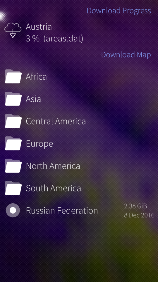
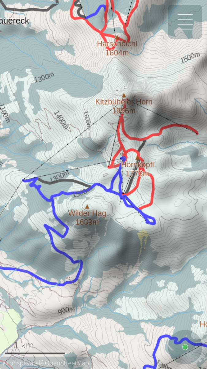
You can choose one from multiple map styles: standard, outdoor, public transport or winter sports. All with the same database that can be downloaded (per state) directly from the application for offline usage. Data on the server covers whole planet and are updated monthly from OpenStreetMap data. You can generate your own extract eventually, all tools are open-source and OpenStreetMap data are free!
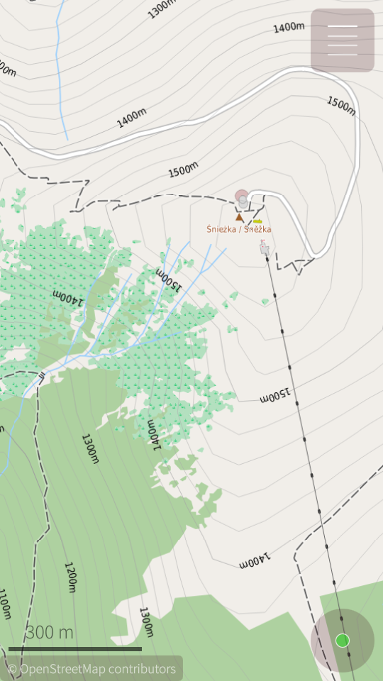
For better outdoor experience, databases (almost all) contains elevation contours and hillshade overlay (online) can be displayed. For areas not covered by offline data are used online maps provided by OpenStreetMap or Stamen Design. But search and navigation works only with offline data.
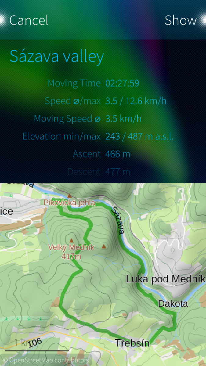
Your favourite places (waypoints) can be stored to collections and exported to GPX files later. It is even possible to import tracks and waypoints from GPX files, display it on map or show simple statistics.
OSM Scout for Sailfish OS is developed as open-source (GitHub) by volunteers in their free time. You can help to improve this application by reporting bugs, creating translations or developing new features. Any help is welcome.
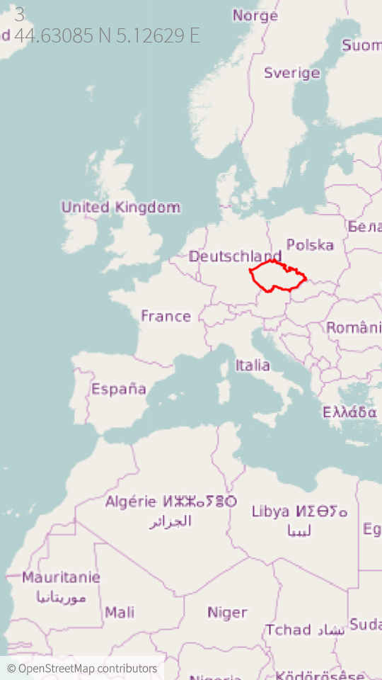
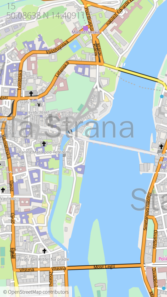
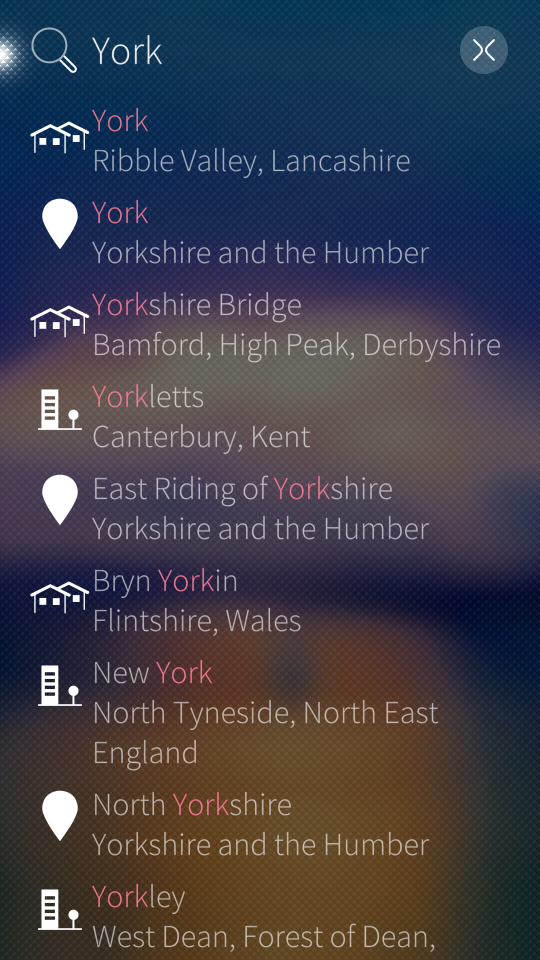
Screenshots:
Category:
Keywords:
Application versions:
| Attachment | Size | Date |
|---|---|---|
| 2.34 MB | 18/12/2025 - 02:30 | |
| 2.28 MB | 18/12/2025 - 02:30 | |
| 2.24 MB | 18/12/2025 - 02:30 | |
| 2.93 MB | 23/02/2026 - 01:47 | |
| 2.86 MB | 23/02/2026 - 01:47 | |
| 2.82 MB | 23/02/2026 - 01:47 | |
| 3.75 MB | 26/05/2026 - 23:52 | |
| 3.85 MB | 26/05/2026 - 23:52 | |
| 3.79 MB | 26/05/2026 - 23:52 |
Changelog:
* 2026-05-24 v2.43
- fix regression: render overlay objects even when offline map is disabled
- search in basemap, it allow to search country names or capital cities even in case that specific map is not downloaded
- fix daylight switch, when some area patterns do not update its colors
- fix: loading missing route data on stylesheet change
Full changelog on Github
Comments
Karry
Sun, 2023/01/22 - 17:29
Permalink
Hi. Thank you for the report. I believe that it was always like that. But you are right, you want to see elevation always in meters / feets. It will be easy to fix it, this is just UI representation.
zipotron
Wed, 2023/01/25 - 17:02
Permalink
I thoungt was working before, but maybe it was because I didnt go high enought!
silta
Fri, 2022/04/01 - 00:03
Permalink
Hi Karry, I would try to reflash my X10 II. Could you tell me how to backup my collections (in german Sammlungen)?
Thanks in advance, silta.
Karry
Fri, 2022/04/01 - 01:37
Permalink
Hi, you may install My Backup, enable OSM Scout backup in the My Backup UI and then do usual system backup...
Or just backup .local/share/cz.karry.osmscout/OSMScout/storage.db file in your home directory...
defactofactotum
Sun, 2022/04/24 - 18:55
Permalink
Hi Karry, thanks for this great app. I'm transferring files from an XZ2 to a pinephone...do you know where they should go...I can't find them anywhere? The file structure is completely different. TIA
Karry
Mon, 2022/04/25 - 10:09
Permalink
I would expect that it will be on the same path on all ports... If it is not there, just start harbour-osmscout from terminal and look for message with "Storage" during startup. It will tell you where the database is stored. For me it is:
defactofactotum
Wed, 2022/04/27 - 20:56
Permalink
Thanks, yes, it's in the same place but there were only 3 files under 'share'. I updated file browser and then there were 22! Anyway, all done, thanks.
delocoyo
Thu, 2021/12/02 - 11:20
Permalink
Is OSM sending skme information to Google? Or is it using something from it?
Karry
Thu, 2021/12/02 - 12:29
Permalink
Nope. OSM Scout is not using Google services for anything. Map rendering, search and routing is done offline, directly on the device. There are just some online tile services that may be used with OSM Scout:
But online tiles may be disabled in Map menu.
tyron98
Wed, 2021/11/17 - 12:30
Permalink
Version 2.18-1 - export of recorded tracks is not available - error when opening "collections": "could not load page".
Karry
Wed, 2021/11/17 - 18:20
Permalink
Hi. From version 2.16 is used new sharing api. It require SFOS at least 4.2. Older systems, like that version on Jolla 1, are not fully supported anymore. Sorry.
tyron98
Thu, 2021/11/18 - 00:16
Permalink
Can I find the old version, previously 2.16?
Karry
Thu, 2021/11/18 - 00:56
Permalink
You can find all releases on github. Version 2.15 is here: https://github.com/Karry/osmscout-sailfish/releases/tag/v2.15
Why you are using older SFOS? You are using Jolla One? Alternatively, you can build current master branch and just revert these four commits: https://github.com/Karry/osmscout-sailfish/pull/267/commits
tyron98
Thu, 2021/11/18 - 21:05
Permalink
Thanks for your help!)
My phone - inoi r7, sailfish mobile os rus 4.1, is not updated to versions 4.2, 4.3.
slava
Thu, 2021/11/18 - 01:19
Permalink
I ended up detecting sharing API version at runtime:
https://github.com/monich/harbour-foilpics/commit/33724fb
Even though I keep Sailfish 4.0 on my daily device, I do respect people who upgraded to 4.2 and even beyond.
Karry
Thu, 2021/11/18 - 10:33
Permalink
Well, I don't want to maintain such hacks. I want to use recent available APIs and have clean code... But in other hands, I understand that some people cannot upgrade to recent versions easily. I still have working Jolla 1 on my desk and using it for testing time-to-time...
For that reason, I prepared Jolla1 branch with reverted related commits (new Sharing api) and create new package: harbour-osmscout-jolla1 Please keep in mind that it is not tested yet, I am not at home right now :-) I will merge new features, that are compatible with SFOS 3, to this branch, but I will not test it on my daily driver device.
BlaeX
Thu, 2021/09/09 - 16:46
Permalink
Still the best OSM-Nav-app on SFOS. Thanks for your great work!
One suggestions for improvement:
Offer to orient the map northwards while navigating
Karry
Mon, 2021/12/27 - 14:51
Permalink
Hi. You can disable auto rotation during navigation with recent release (2.20). You can found it in "Settings" or you can lock it in by "double tap" on compass icon...
slava
Fri, 2021/07/30 - 16:56
Permalink
The map looks like a low-res image scaled up, at least on my XA2. Is that a bug or a feature? A high-res image scaled down would probably look better (at expense of higher CPU/memory usage, though). Otherwise a great app, thank you!
Karry
Tue, 2021/08/17 - 10:25
Permalink
Hi. Do you mean online map / tiles, or map rendered "offline", on the device? It may happen that online tiles looks blury, because they are rendered with 96 DPI, text would be too tiny on phone. Application is upscaling it. You can control upscale ratio in map settings.
"Offline" tiles are rendered for specific screen DPI (and configured upscale). But when you are changing zoom, even offline tiles are upscaled when your zoom is between two "zoom levels".
Offline rendring is priority for me. Online maps are used just as complement.
slava
Thu, 2021/09/09 - 18:49
Permalink
Yes, I was using online map. A silly question - if you can get offline tiles rendered for the screen dpi, why not to do the same thing for online tiles?
Karry
Sun, 2021/09/12 - 10:30
Permalink
Because OSM Scout is using raster online tiles, that are rendered on 3rd party servers that are out of my control. And they are rendered with 96 DPI.
slava
Sun, 2021/09/12 - 13:18
Permalink
That's what I suspected. But then who's generating offline tiles for you and what stops you from doing the same trick online?
Karry
Sun, 2021/09/12 - 14:21
Permalink
Database for offline rendering contains "raw" geographical coordinates of individual objects. During rendering on the device, these coordinates are converted to screen points and rendered by specified style. To do the same (or similar) for online tiles would require to use some provider of vector tiles and slighly modify renderer, or use different renderer than libosmscout. It is huge amount of work and I would prefer to invest time to another features...
slava
Sun, 2021/09/12 - 18:16
Permalink
Ok, understood! Athough I still find it hard to believe that online servers can only do 96 dpi these days.
mux
Fri, 2021/07/30 - 15:59
Permalink
Hey Karry. Thank you very much for the latest OSM Scout version along with newest feature improvments, particually making it possible to change track color. Works fine!
BlaeX
Fri, 2021/06/18 - 09:57
Permalink
Thx a lot for this beautiful piece of software!
zipotron
Tue, 2021/04/27 - 13:55
Permalink
Hello Karry, and for add something to the Mux message, to display the current speed in the main screen while you record a track could be useful for bikers.
mux
Sun, 2021/04/25 - 09:35
Permalink
Hi Karry, thanks for OSM Scout App. It is great trooper for my outdoor activities!
One thing that I like to suggest for visibility improvements. IMO, sometimes it makes it hard with the green current location dot figuring my location, particularly when a track is loaded and begin surrounded by wood landscape plus strong sunlight on the display.
An option to change the current locations dot color would be great, or red as a default would may improve the described situation.
I hope that this considerations has been useful!
zipotron
Sat, 2021/04/17 - 21:34
Permalink
Hi again Karry, I just wanted to report a bug, from I updated to the version 2.12, when you are following a car route, and miss a turn for example, OSMScout instead recalculate, start to behave wired, not showing the route in the map anymore, not following the gps position in the screen, I had to rollback to the version 2.11 because this new version 2.12 is unusable. Please, dont be offended, I just want to help to keep the app as nice as it is.
Pages