OSM Scout
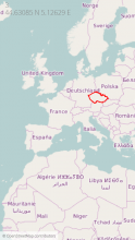
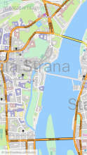
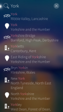
OSM Scout for Sailfish is map viewer with search and navigation, fully functional without internet connection.
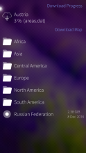
You can choose one from multiple map styles: standard, outdoor, public transport or winter sports. All with the same database that can be downloaded (per state) directly from the application for offline usage. Data on the server covers whole planet and are updated monthly from OpenStreetMap data. You can generate your own extract eventually, all tools are open-source and OpenStreetMap data are free!
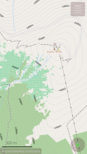
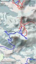
For better outdoor experience, databases (almost all) contains elevation contours and hillshade overlay (online) can be displayed. For areas not covered by offline data are used online maps provided by OpenStreetMap or Stamen Design. But search and navigation works only with offline data.
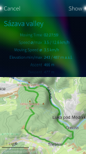
Your favourite places (waypoints) can be stored to collections and exported to GPX files later. It is even possible to import tracks and waypoints from GPX files, display it on map or show simple statistics.
OSM Scout for Sailfish OS is developed as open-source (GitHub) by volunteers in their free time. You can help to improve this application by reporting bugs, creating translations or developing new features. Any help is welcome.
Category:
Keywords:
| Attachment | Size | Date |
|---|---|---|
| 2.33 MB | 13/05/2025 - 07:46 | |
| 2.27 MB | 13/05/2025 - 07:46 | |
| 2.5 MB | 13/05/2025 - 07:46 | |
| 2.34 MB | 15/06/2025 - 20:23 | |
| 2.28 MB | 15/06/2025 - 20:23 | |
| 2.5 MB | 15/06/2025 - 20:23 | |
| 2.34 MB | 16/10/2025 - 07:59 | |
| 2.28 MB | 16/10/2025 - 07:59 | |
| 2.51 MB | 16/10/2025 - 07:59 | |
| 2.34 MB | 18/12/2025 - 02:30 | |
| 2.28 MB | 18/12/2025 - 02:30 | |
| 2.24 MB | 18/12/2025 - 02:30 |
* 2025-12-17 v2.41
- wrap long error messages in map downloader
- support for opening "geo" links in the main package, no need to install separate harbour-osmscout-open-url package anymore
Full changelog on Github


Comments
Karry
Fri, 2021/04/30 - 00:30
Permalink
I was able to find the cause finally! Fix is in master branch, I will release new version soon.
Karry
Mon, 2021/04/19 - 14:39
Permalink
Thank you for report. I will look on it this week.
zipotron
Sat, 2021/04/03 - 09:23
Permalink
Hi Karry, I use your app as a navigator (car and trekking), and is completely functional, but I detect that, sometimes, in my Xperia X, there is a delay when you are following the navigator, some second, but enought delay to miss a turn in a crossroad. Also, could be nice for the trekkins, to have the posibility to attach audio photo and video to the recorded track.
As always, thanks for bring us this amazing app!
greatneon
Thu, 2021/02/25 - 23:13
Permalink
Hi tehre. @Karry thank you for such a great app! I'm tracking my dog's movement (also mine lol) And I was wondering if there will be any feature of syncing with nextcloud's GpxMotion or GpxPod in the near future?
Btw do you know of such app that can sync gps data with nextcloud?
Thank you again!
Termitebug
Tue, 2021/03/09 - 17:40
Permalink
Try LiveTrack SF app with NC PhoneTrack if it works.
Karry
Fri, 2021/02/26 - 01:10
Permalink
Hi. Such feature is on my todo list for long time. It would be great if Jolla will open access to OwnCloud/NextCloud api, but it seems that it is not planned in near future. In such situation, OSMScout would need integrate all necessary pieces... I cannot say if, or when it will be done, it is complex task.
I don't know about any application that allow synchronise gpx tracks with private cloud service.
zipotron
Fri, 2021/02/19 - 19:42
Permalink
Hello Karry! Last update was amazing, thanks! Just realized the other day driving that speedometer is not workingood, I checked with another GPS device and speed is wrong. It's not important but just to take in count.
Karry
Fri, 2021/02/26 - 01:16
Permalink
Hi Zipotron. Application is computing speed from possition changes. It seems that it is sensitive to update delays, I experience this problem too. Recently updated api (with SFOS 4) should provide ground speed to qml, I will look at it. This value should be computed direcly on the gps chip and should be more reliable.
Termitebug
Thu, 2021/02/18 - 01:14
Permalink
Hi, can I use ERSI shapefile .shp format to generate my own import?
Karry
Thu, 2021/02/18 - 12:23
Permalink
Hi, osmscout don't support direct import of shapefiles, we support just import of OpenStreetMap data, in XML (.osm) or protobuffer (.pbf) format. The only exception is shapefile with coastlines...
But there are some tools that may be used to convert shapefile to OSM data file.
What is your usecase? What data you have in mind?
zipotron
Wed, 2021/01/06 - 19:33
Permalink
Hi Karry, from the last update the navigation is very friendly. I did a car trip of 1000km last days and I found OSMScout completely functional. Just one thing I missed, to configure the route calculation for find the shortest way or the fastest one. Now is just showing the shortest... Thanks for thes amazing job
Karry
Thu, 2021/01/07 - 11:42
Permalink
Hi Zipotron. It is great to hear that. I am happy that at least someone is using navigation :-D Routing and navigation is far from perfect from my point of view :-/
Routing in reallity is trying to find a fastest route by default. But in some conditions it for example evaluates route via residential area faster than using main route. It is opposite in reality. I tried to address that by adding turn (time) penalty. But it makes situation worse on different places. Long story short, usable routing requires many fine tunnings...
I will have to create some set of automated tests to make sure that some change don't make situation even worse globally. I hope that I will find some time for improve routing/navigation it this year.
I wish you great year 2021. Lukas
danfin
Sun, 2020/12/20 - 15:16
Permalink
trying to import GPX points issues 'XML error' messages and does not import the file. OsMand imports the same files no problem. (trying to import POI's for EV charge stations)
Karry
Sun, 2020/12/20 - 20:43
Permalink
Hi Danfin. Can you share the GPX file that you are trying to import? I need to reproduce this bug to be able fix it. It would be great when you create issue on Github and attach gpx file there...
Thanks, Lukas
danfin
Wed, 2020/12/23 - 09:43
Permalink
hullo Karry, being not used to Github (somehow been messing with login), i put them on my Googledrive:
https://drive.google.com/drive/folders/1jqgmsBqMsSp37xmK_T6es-CfjPP-POT9...
one of the files, ParkCharge, imports ok, the other two don't.
Karry
Wed, 2020/12/23 - 10:18
Permalink
It is strange, I imported all three without problem. Could you please start OSM Scout from terminal with debug logging and try it again please?
There should be some error when import fails... Or you may redirect log to file and then upload it somewhere... Thanks
danfin
Sun, 2021/01/31 - 13:52
Permalink
hullo Karry, I did not investigate further, trying to produce a GPX containing all POI's I need, first. This works quite well now (charge stations for EV vehicle). But in OSM Scout, I can't view my POI's sorted by distance (closest first). Selecting POI's as a navigation target is tricky, as they do not list in the 'search' catalog, and they do not seem to show on the 'pick a place' map view. So, it's not quite easy to select a POI as navigation target, yet. Actually, go to Collections, sort by distance, then route to slected POI would be perfect (for me)
Importing GPX seems very ok however. Maybe I did something wrong.
Karry
Mon, 2021/02/01 - 10:37
Permalink
Hi. Thank you for this comment. I was thinking how to make your live easier.
Regarding this point, did you consider to import these data sets with charging stations to OpenStreetMap? It would be beneficial for all people using OSM data. If license of the data sets don't allow it, you definitely should map missing stations when you visit them ;-) See related tag on OSM wiki
danfin
Tue, 2021/02/02 - 19:20
Permalink
hullo Karry
yes I am thinking about importing the charging stations to OpenStreetMap, but I realized it's so many, even in my small country. Currently I only have a stupid GPXviewer installed, so each data set would have to be copied manually ;(
Search nearby in a POI list sounds perfect! Maybe even with a user defineable search radius?
zipotron
Sat, 2020/10/10 - 17:17
Permalink
Hi again! Just wanted to report a bug, if you are navigating (whitout voice of course) and playing music at the same time, the player get stop in every indication.
Karry
Sun, 2020/10/11 - 18:21
Permalink
Hi. Thank you for the report. You mean with or without selected voice? I made few experiments, and I was not able to keep media player playing... So I create question on the forum: https://forum.sailfishos.org/t/playing-audio-file-with-qmediaplayer-paus...
It is weird to me.
zipotron
Mon, 2020/09/28 - 15:44
Permalink
Hi Karry! Again I want to make a suggestion, is about navigation, when you set a destiny and OSMScout calculate and shows you the route, the line in the map is so thin and sometimes the same color as the road and is so dificult to see the route in the map. could be nice to change color and width of the route's line in settings.
Thanks!
Karry
Sun, 2020/10/04 - 22:28
Permalink
Hi. I know about that issue. But I don't want to introduce another setting, but tune map stylesheets.... Because there are multiple stylesheets, some of them have flags to switch day and nigh mode... So, it is difficult to find one color for all stylesheet and flag combination... Just time is limited :-)
zipotron
Mon, 2020/10/05 - 10:08
Permalink
Hi! Yes, I see, play with colors may not solve the problem, but... Just make the route line wider? At least in car navigation. Anyway the app is amazing, thanks for it!
Kabouik
Sun, 2020/08/02 - 16:14
Permalink
Uh, weird, they suddenly show up. I didn't change anything, the only difference is the offline maps finished downloading (but maps were showing fine, just the traces were missing). Sorry for the noise!
Karry
Sun, 2020/08/02 - 21:40
Permalink
Hi. Yes, it is caused by the fact that there is no offline database... OSM Scout needs at least one database downloaded and initialised to be able display custom types, like gpx routes. It is known limitation of the renderer...
Kabouik
Sun, 2020/08/02 - 16:06
Permalink
Hey, my gpx files (downloaded from Internet, not recorded using the app) load fine in OSM Scout and waypoints are correctly found, but the track line is not visible even when I choose to show the track on map. Is it a known issue or is it related to the files I downloaded? I assume they are supposed to show a track, but maybe something is not compatible? Maep-qt correctly shows the traces.
zipotron
Sun, 2020/07/19 - 13:54
Permalink
Hi again Karry! I want this time to make a suggestions, Last weekend I tried to use Osm Scout on a car route, the big problem is, Osm Scout do not keep on the screen during navigation, at last I had to use Maps just for safety. I think add in settings 'keep screen on' could make Osm scout a good alternative to Google Maps when you drive /ride. Other minor point, I also miss to type GPS coordinates for locate point in map or navigate.
Thanks man! I hope that this considerations has been useful!
Karry
Tue, 2020/08/11 - 09:34
Permalink
Keep display on (during navigation) will be possible from next release ;-)
To the second point, you can put GPS coordinates to search. But there is thousand of formats how GPS coordinates may be written, we supports just the most common :-) Function to parsing them is here: https://github.com/Framstag/libosmscout/blob/master/libosmscout/include/...
ezameht
Wed, 2020/07/15 - 16:47
Permalink
Thank you for the app! Two questions: 1) Is it possible to draw the currently recorded track on the map? 2) Can the map be oriented by compas?
Pages