
OSM Scout

OSM Scout for Sailfish is map viewer with search and navigation, fully functional without internet connection.
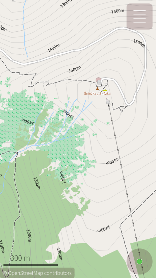
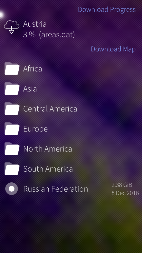
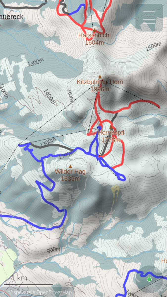
You can choose one from multiple map styles: standard, outdoor, public transport or winter sports. All with the same database that can be downloaded (per state) directly from the application for offline usage. Data on the server covers whole planet and are updated monthly from OpenStreetMap data. You can generate your own extract eventually, all tools are open-source and OpenStreetMap data are free!
For better outdoor experience, databases (almost all) contains elevation contours and hillshade overlay (online) can be displayed. For areas not covered by offline data are used online maps provided by OpenStreetMap or Stamen Design. But search and navigation works only with offline data.
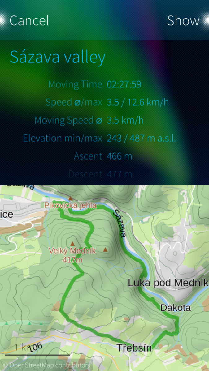
Your favourite places (waypoints) can be stored to collections and exported to GPX files later. It is even possible to import tracks and waypoints from GPX files, display it on map or show simple statistics.
OSM Scout for Sailfish OS is developed as open-source (GitHub) by volunteers in their free time. You can help to improve this application by reporting bugs, creating translations or developing new features. Any help is welcome.
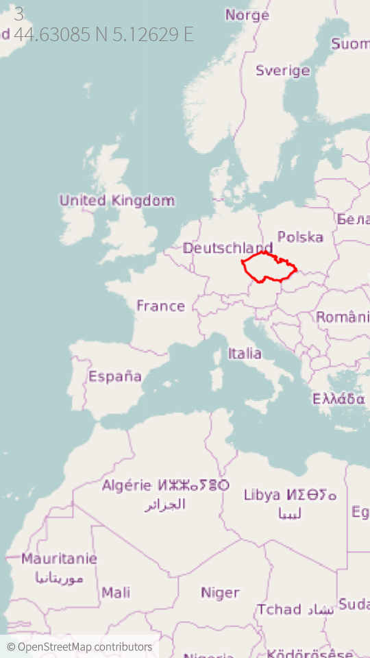
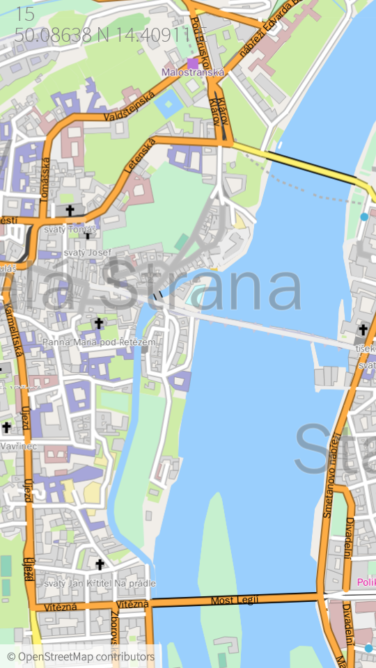
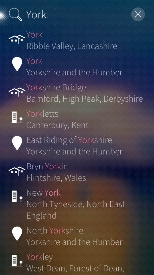
Screenshots:
Category:
Keywords:
Application versions:
| Attachment | Size | Date |
|---|---|---|
| 2.34 MB | 18/12/2025 - 02:30 | |
| 2.28 MB | 18/12/2025 - 02:30 | |
| 2.24 MB | 18/12/2025 - 02:30 | |
| 2.93 MB | 23/02/2026 - 01:47 | |
| 2.86 MB | 23/02/2026 - 01:47 | |
| 2.82 MB | 23/02/2026 - 01:47 | |
| 3.75 MB | 26/05/2026 - 23:52 | |
| 3.85 MB | 26/05/2026 - 23:52 | |
| 3.79 MB | 26/05/2026 - 23:52 |
Changelog:
* 2026-05-24 v2.43
- fix regression: render overlay objects even when offline map is disabled
- search in basemap, it allow to search country names or capital cities even in case that specific map is not downloaded
- fix daylight switch, when some area patterns do not update its colors
- fix: loading missing route data on stylesheet change
Full changelog on Github
Comments
Pemek
Sun, 2020/01/12 - 19:02
Permalink
Hi,
One question: I can't find last search neither in options (to enable) nor in search page. It is quite annoying when I look for sth, and then want to navigate there. I have to reenter the same data in search field. Is it possible to do it somehow? Btw, thanks for great piece of software.
Karry
Sun, 2020/01/12 - 20:55
Permalink
Sorry, it is not possible now.
Btw, you may start navigation directly from search result (try context menu on result row) or store your favourite places to collections...
Ta_das
Sat, 2019/08/17 - 13:27
Permalink
OsmScout does not show on map imported gpx trail created by OsMapper from Openrepos. But it goes to correct place in the map, also it shows information of the path: times, length, elevation. Time is not correct, as probably OsMapper records it in local time, and OsmScout understands as UTC. modRana fails to load the track as well. Only Halftrail shows it, but this app doesnt show any gpx info, at least I did not figured out how to look at it.
EDIT: Now I have downloaded ofline maps and tracklog path is shown on the map.
Thanks for the great app. I will continue exploring it.
The only wish would be that the tracklog path line on map would be thinner, or of configurable thickness.
simosagi
Mon, 2019/06/24 - 11:56
Permalink
Weird, I have OSM Scout 1.10-1 installed, today I saw the update to 1.12 available on Openrepos but even after forcing a refresh of the O.R. repo cache I don't get a notification that an update is available.
Karry
Mon, 2019/06/24 - 12:24
Permalink
Weird. It will be some Storeman issue I guess. You can try pkcon from command line to investigate real state and then report issue to Storeman...
Few minutes ago was update approved in Harbour, you can update to latest version there...
simosagi
Thu, 2019/06/27 - 13:51
Permalink
Hmm... I tried to download the rpm and install it locally with "pkcon install-local harbour-osmscout-1.12-1.armv7hl.rpm", but I get "Fatal error: nothing provides libstdc++.so.6(CXXABI_1.3.8) needed by harbour-osmscout-1.12-1.armv7hl"
I found this https://together.jolla.com/question/206727/harbour-is-rejecting-rpm-pack... discussion in TJC, so I wonder, do I need to upgrade to Sailfish 3.x to have access to the necessary libraries? (my device is still a SFOS 2.2)
Thanks
Karry
Thu, 2019/06/27 - 15:47
Permalink
Yes. The recent OSM Scout version was build with c++14 support and it require recent standard c++ library that is available just in SFOS >= 3.0.3... If it is possible, upgrade to recent version :-)
simosagi
Fri, 2019/06/28 - 13:15
Permalink
All right, thanks. I've been planning to do the upgrade since already too long :-)
Anyway, perhaps a note on the SFOS 3.0.3 requirement in the OSM Scout description would be good for other interested users.
LeoQTMoura
Thu, 2019/03/21 - 01:48
Permalink
i loved the app , and i want to help translate to portuguese br .
Karry
Thu, 2019/04/11 - 08:54
Permalink
Great to hear that! Simplest way how to translate it is via Transifex page: https://www.transifex.com/osm-scout/osm-scout/ Just register there and send me request for new language. You may start translating after acceptation...
Pelzlurch
Sun, 2019/03/17 - 15:00
Permalink
Hi Karry, I'm one of the guys who are doing the German translatiion. Unfortunately I made a bigger mistake the last time. So one of the the mainfunktions is at the moment quite miserably translated. I fixed the translations now. Sorry for that. Just wanted to inform you.
Karry
Mon, 2019/03/18 - 09:27
Permalink
Hi. No problem. Some phrases may be confusing without context. I will replace "Routing" by "Navigation" in the source. I will take a look to one bug in collections and release version 1.8 soon...
PawelSpoon
Sat, 2019/03/16 - 23:58
Permalink
Do you see any chance.to.use osmscout and.osmserver side by side ?
Karry
Mon, 2019/03/18 - 10:00
Permalink
Well, what do you looking for exactly?
- If you want to share downloaded databases (between "OSM Scout" and "OSM Scout server"), it should work basically, when you are using libosmscout backend in the server. You should just create symlink between directories that are used for the lookup...
- When you want to use tiles rendered by the server in OSMScout, I am not sure it the server still supports bitmap tiles. If yes, you can add local server as a another map provider. See `/usr/share/harbour-osmscout/resources/online-tile-providers.json` resource.
- Use server as search and routing backend - it is not possible even theoretically. libosmscout models don't support requests to online services now and it is not on my todo list. But merge request are welcome ;-)
With my OSM Scout, I want to provide simple-to-use map application that can be distribured via Jolla harbour and its restrictive rules. I want to target all user, even without Linux experience. As I understand @rinigus OSM Scout server and his work around MapBox OpenGL map plugin, he is targeting to geek users and want to integrate this server approach to Sailfish OS. But as I see on the Sailfish meetings and the mailing list, it will be long run :-(
Long story short, both applications are developed separately without its integration. It is not even on my todo list. I am developing it in my free time, just for fun and my needs. If you want to contribute, just lets discuss your ideas. I am open to merge requests ;-)
PawelSpoon
Thu, 2019/03/21 - 17:18
Permalink
i would just like to share the downloaded databases, so point nr 1
Historyscholar
Mon, 2018/12/03 - 10:08
Permalink
不错的软件,Thanks !
Karry
Sun, 2019/03/17 - 16:20
Permalink
You are welcome ;-)
danfin
Wed, 2018/10/24 - 19:00
Permalink
if I activate a GPX file in my collection, I don't see anything on the map. What could be the reason?
Karry
Thu, 2018/10/25 - 22:57
Permalink
Hi. UI is little bit confusing here. When you click the "Show" button on the track detail, it show you area with the track, but not track itself. But you can display complete collection on the main map - just activate context menu for the collection (long-press) and select "Show on map". On click to the "star" icon...
I am not sure how to improve it - I want to keep workflow simple, manage visibility for each track or waypoint separately may be annoying. Maybe "activate" complete collection when "Show" button is pressed for some child? I don't know...
danfin
Sat, 2018/12/22 - 15:01
Permalink
I can do that, however I still can't see my tracks, and also I miss centering on those tracks or even routing along the tracks, something like routing.. follow selected track, ... go to start of track. It would be good if the 'show on map' dialog contained a hint on how the track will look. (is it the orange line? or is it the red dotted line?). Maybe my imported GPX are defective... however they showed in other map apps.
Karry
Fri, 2020/01/10 - 09:55
Permalink
I see that I don't reply to your comment after year :-/ Sorry. It is working now? For displaying track you have to have active offline renderer. So offline rendering have to be enabled and you have to have some offline map... If you still struggle with it, please create issue on the Github and if possible upload your track...
Historyscholar
Sun, 2018/10/21 - 18:07
Permalink
no chinese
Karry
Sun, 2018/10/21 - 20:19
Permalink
All translations are created by cummunity. If you understand Chinesse, you can contribute :-) It is simple, you can create translation via Transifex: https://www.transifex.com/osm-scout/osm-scout/dashboard/ or create pull request on the Github. Here is how: https://github.com/Karry/osmscout-sailfish/wiki/Howto-create-translation
rinigus
Tue, 2018/08/07 - 12:45
Permalink
@Karry: Great work on labels layout engine! Congratulations, it looks much better than before!
Karry
Sat, 2018/08/11 - 00:20
Permalink
Great to hear it :-) It still has few issues (small space between labels, problems with tile rednering...). but I feel that it is improvement. There is just missing DirectX implementation and this change may be merged to Tim's upstream...
danfin
Mon, 2018/08/06 - 14:16
Permalink
any plans on adding GPX display or even Navigation along GPX Tracks? Would be a great feature.
Karry
Mon, 2018/08/06 - 17:13
Permalink
Yes, I am planning track recording / displaying with GPX export and import. But I am not able to promisse when it will be finished... I am working on bookmarks right now and should be included in next release (next month?) and GPX maybe later this year...
Merge requests are welcome ;-)
Navigation with gpx is not on my (short-term) todo list now, I want to make standard navigation usable first (with route from router).
Jordi
Sun, 2019/12/29 - 14:32
Permalink
I hope that track recording is still planned at some stage!
Karry
Thu, 2020/01/02 - 09:29
Permalink
Definitely! Track recording is my priority now.
Jordi
Mon, 2020/01/13 - 19:11
Permalink
Excellent news!
Pages