
Pure Maps

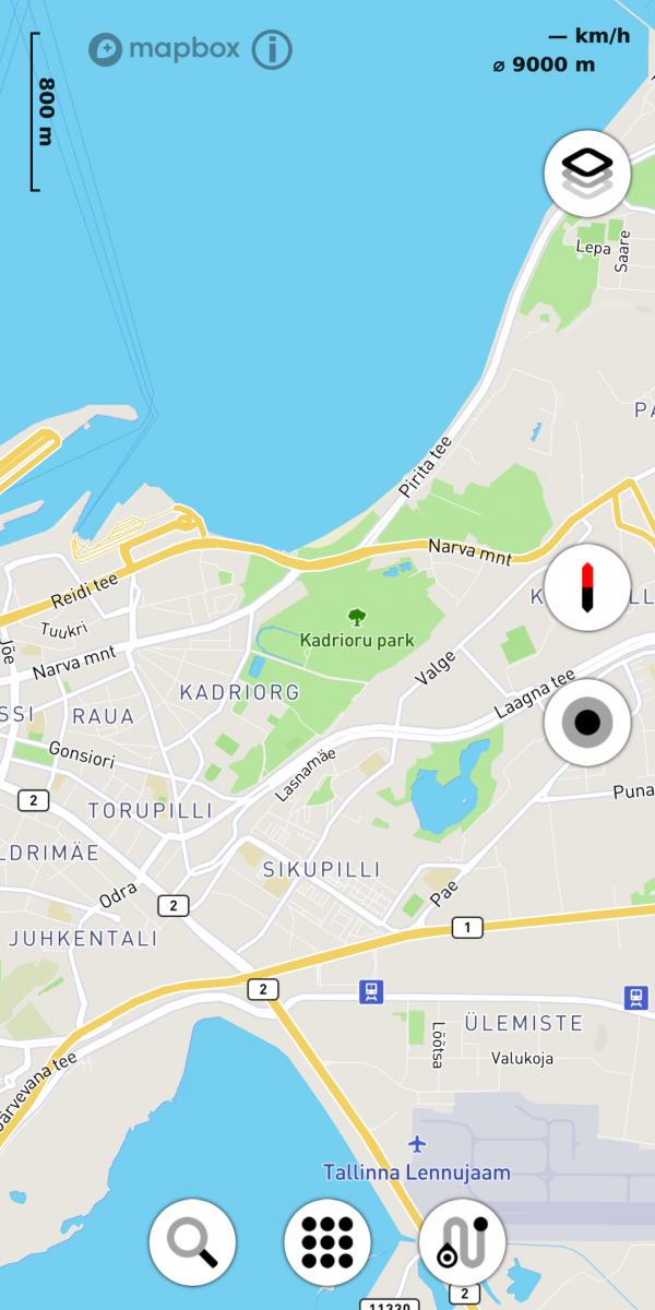
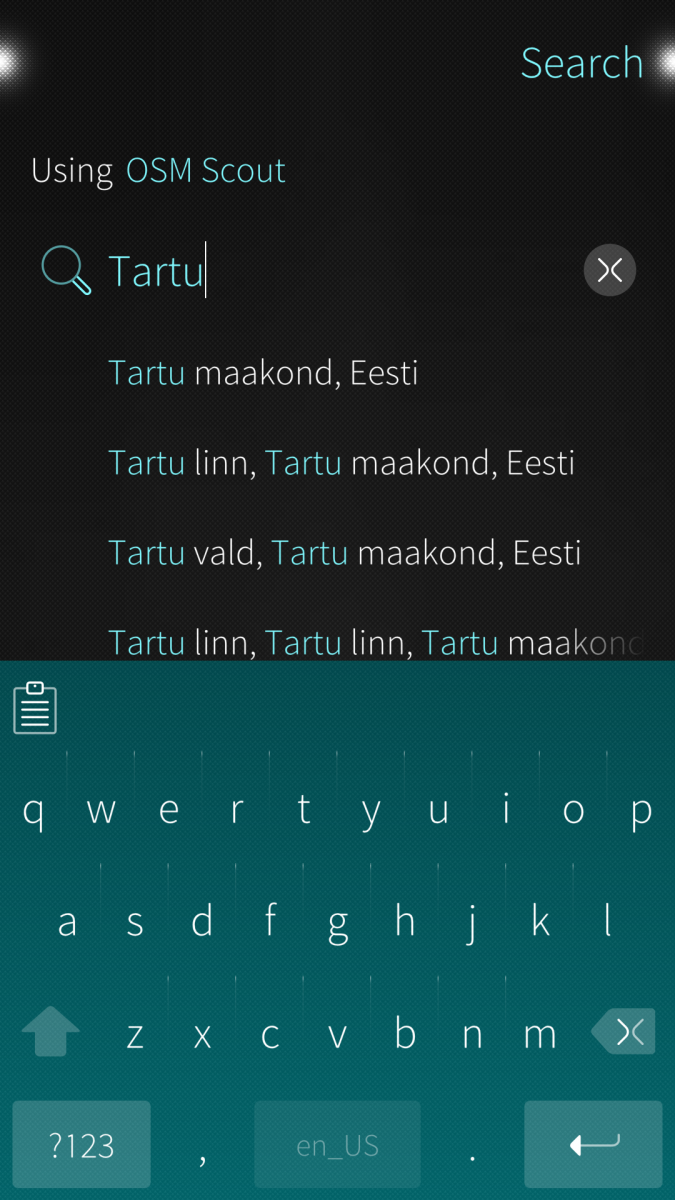
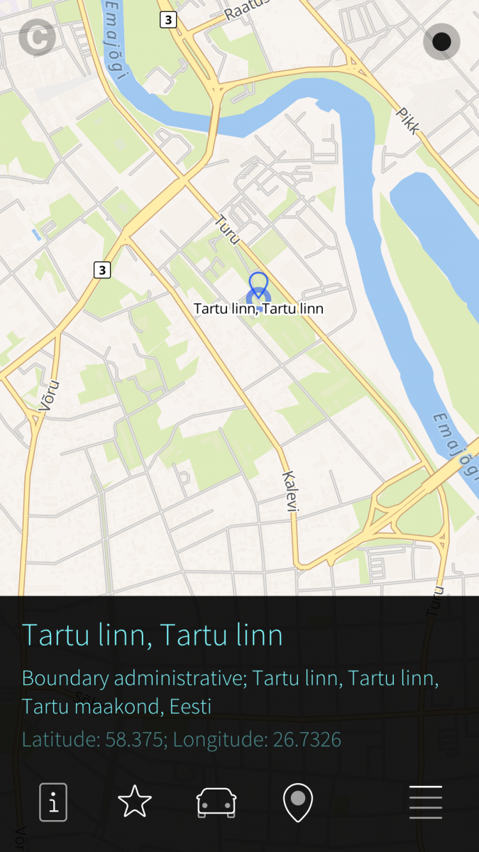
Pure Maps is a full-featured map and navigation application allowing you to explore maps, search for addresses and points of interest, as well as assist with navigation. For that, it uses online or offline service providers.
Offline maps, search and routing is possible with OSM Scout Server. Pure Maps will list OSM Scout Server among the providers if you have it installed. For it work, you'll also need to have the server running and map data on your device. See the OSM Scout Server documentation for installation instructions and follow setup instructions for Poor Maps.
Note: Online maps users are requested to register their own Mapbox GL key and enter it through the preferences of the application. This will allow us to use default key for application testing and provide the service without hitting free tier limits. Reasoning behind the requst is explained at TMO post, see follow up messages on TMO pages for users feedback and small details on how to enable and test the personal key. Note that without significant number of users moving to the personal keys, Mapbox key will be revoked and the users of Mapbox tiles will not be able to access it.
Note, SFOS releases support: As starting from version 2.7.5 Pure Maps relies on QtPositioning 5.4, SFOS versions before 4.0 are not supported. Corresponding commits are 616c406a7efdb1fe9cfa841ff0bbc8250860afb0 and ed4290634753f1bdcf962de35f36e0f092249616.
NB! Updates are currently posted at Chum repositories and official Jolla Store only.
As of 23 Jan 2019, the public Mapbox access key has been revoked. Users are welcome to register their private key in the application.
Requirements:
- Mapbox GL Native QML component for map display and interaction, should be installed as a dependency automatically.
- Voice navigation requires that you manually install a text-to-speech (TTS) engine – Mimic, Flite, PicoTTS and Espeak are supported. Their quality is about in that order, with Mimic and PicoTTS available from this repository. See corresponding TTS engines for language covereage.
Pure Maps is a fork of WhoGo Maps and continues its legacy. Reasons for forking described at corresponding post.
License: GPLv3
Source code: https://github.com/rinigus/pure-maps
Translations: https://www.transifex.com/rinigus/pure-maps
Official TMO thread: https://talk.maemo.org/showthread.php?p=1547484
Matrix chat: #pure-maps:matrix.org
Donations: https://rinigus.github.io/donate
Screenshots:

Category:
Keywords:
Application versions:
Changelog:
Comments
rinigus
Tue, 2019/05/07 - 06:28
Permalink
"pkcon refresh" usually resolves missing package issues.
explit
Thu, 2019/04/11 - 12:07
Permalink
There seem to be a Problem with the upcoming SailfishOS 3.0.3.x (cebta) Version.
Is it possible to do something here ?
nemo@Sailfish ~]$ harbour-pure-maps
[D] unknown:0 - Using Wayland-EGL
[D] unknown:0 - Got library name: "/usr/lib/qt5/qml/io/thp/pyotherside/libpyothersideplugin.so"
[D] onCompleted:355 - Warning: specifying an object instance for initialPage is sub-optimal - prefer to use a Component
[D] unknown:0 - Geoclue client path: "/org/freedesktop/Geoclue/Master/client3"
[W] unknown:0 - QMetaMethod::invoke: Unable to handle unregistered datatype 'QGeoPositionInfo'
[W] unknown:0 - [ INFO ] "{QSGRenderThread}[General]: GPU Identifier: Adreno (TM) 508"
[D] unknown:0 - Cannot convert: QVariant(void*, 0x0)
sailfish-qml: symbol lookup error: /usr/lib/qt5/qml/MapboxMap/libqmlmapboxglplugin.so: undefined symbol: ubidi_open
[nemo@Sailfish ~]$
Thanks
rinigus
Tue, 2019/05/07 - 06:29
Permalink
not syre, until 3.0.3 will be available at OBS
dirksche
Sun, 2019/03/31 - 01:35
Permalink
Great update. Thank you very much
PawelSpoon
Fri, 2019/03/22 - 10:30
Permalink
Pretty impressive !! Thank you very much !! Heading straight to paypall :)
pvcn
Fri, 2019/03/22 - 08:25
Permalink
Great App, thank you very much for your work! I like the new icon
ferlanero
Fri, 2019/03/22 - 02:49
Permalink
Pure Maps new look is absolutely amazing! Great work Rinigus!
rinigus
Fri, 2019/03/22 - 10:38
Permalink
Its mostly work of Mosen and Fellfrosch from TMO. So, let's thank them :)
carmenfdezb
Fri, 2019/03/22 - 17:05
Permalink
Thanks for the update!! And thanks to Mosen and Fellfrosch for the icons, the app looks really nice ;)
sdiconov
Fri, 2019/03/01 - 17:51
Permalink
It seems that Pure Maps lack support for OSM Scout Server (offline maps). Please, add this feature, because Internet connection is not always available. especially when you are far away and need navigation badly.
rinigus
Sat, 2019/03/02 - 01:04
Permalink
You have just to enable offline profile in the main menu. That will set osm scout server as default provider for map, search and navigation
crakby
Tue, 2019/02/26 - 10:03
Permalink
Best Sailfish app ever!! Great work, thank you!
Only waiting for touchable POIs, these shown all on the map.
rinigus
Tue, 2019/02/26 - 10:51
Permalink
This is not on sight, at least yet. But you could remind me of that once in a while. Problems are SDK support for such interaction and how to distinguish single click for switching on/off extra map controls VS click on POI. For that reason,we have press and hold for POI selection and, if reverse geocoding finds data, you'll get the data regarding POI as well. Although, its not pulled from Mapbox GL tiles but through additional service
crakby
Fri, 2019/03/22 - 14:14
Permalink
Press and hold is fine, great to be able to access shown POIs in any way. I tried out, because reading the changelog, but did not succeed. Find out, press and hold POI only works in online or mixed mode, but not in offline mode, I'm running the app in. Is this a bug or a SDK limitation?
Great work anyway!
rinigus
Fri, 2019/03/22 - 19:52
Permalink
Long press should always create poi. After that, data is fetched. Its possible that offline database doesn't have it. Note that there are few technical issues with it. Location database has only central points, so it looks for those near your press and hold poi. It doesn't have data on shape and cannot check if poi is within some geometry. For that, different data is needed and maybe I can add it in future. But not that soon...
crakby
Sat, 2019/03/23 - 00:17
Permalink
Thank you for reply. Yes I can see, that offline has different database then online. Some the same entry, but not exactly same place. That might be the reason why offline POI does not choose the POI neer the press and hold, even there are entries. On holiday, offline data can be very useful. Looking forward and you're development is much faster than on jolla side :-)
murfik
Tue, 2019/02/26 - 09:17
Permalink
how to change lang on map (streets)?
rinigus
Tue, 2019/02/26 - 10:42
Permalink
good question. That's not possible right now, except for OSM Scout Server maps where you have choice of local and English names. For Mapbox, it should be possible, but maybe there is a better way than generation of styles for each of the languages using https://docs.mapbox.com/help/troubleshooting/change-language/ . I'll check it out
didilalalagon9
Sun, 2019/02/24 - 21:39
Permalink
Do you have dependencies tha would force Pure maps to update? I set ''Storeman'' to not checking for updates automatically and not notyfing me either but regardless Pure maps always end up updated after few days to latest ver. without my consent or knowledge. Storeman publisher claim that it is not suppose to be a Storeman behavior.
rinigus
Sun, 2019/02/24 - 22:26
Permalink
Recently the updates were rather frequent, but I they should be coming via common mechanisms. Last week there were 2 releases of Pure Maps and one of Mapbox GL QML plugin. One more Pure Maps update is coming soon, later there will be a shorter break, as far as I can see.
didilalalagon9
Mon, 2019/02/18 - 00:18
Permalink
Ok , he my previous comment was for ver 1.15. Quick updade over 1.16 and some of your changes have me loose the proper larger padding between the menu items. So I will stick on 1.15 a little longer to get the time to figure out more your changes vs the advices you replied me about the menuDrawer.qml. Other question/request , in routing option none of the routing engines offer "tunnel" or ''unpaved roads'' . As a camper those to options are concern to me with my travel trailer ( some city underground highways tunnels prohibit any vehicule transporting pressure gas tank like propane). Truck drivers also would apreciate those. As a side note , tunnel avoidance is only supported by too few mapping app . Pure Maps would mark points there.
rinigus
Sun, 2019/02/24 - 22:22
Permalink
Sorry for late reply - wanted to check few things before and got carried away from it.
Routing options are coming from the corresponding routers. The mainly targeted one is Valhalla with its API at https://github.com/valhalla/valhalla/blob/master/docs/api/turn-by-turn/a... . As far as I can see, there is nothing caravan specific nor tunnels.
I would suggest to open an issue with this at https://github.com/valhalla/valhalla/issues and ask for these features. As soon as they are available in Valhalla, its trivial to add them to Pure Maps and provide updated Valhalla via OSM Scout Server for offline routing.
didilalalagon9
Sun, 2019/02/17 - 19:24
Permalink
Great , thank you . Just a few changes for large padding's and ThemeItemSizeLarge in the iconlistitem.qml and in the menupage.qml and I am all set as I wished for.
rinigus
Sun, 2019/02/17 - 20:02
Permalink
You actually have now an opportunity to make it something even better suited for your case. For that, just reimplement MenuDrawer* QML files in https://github.com/rinigus/pure-maps/tree/master/qml/platform.silica . Right now they are symlinks to https://github.com/rinigus/pure-maps/tree/master/qml/platform.generic. For example, you can replace https://github.com/rinigus/pure-maps/blob/master/qml/platform.generic/Me... to load ToolItemPL (in ../platform.silica) and even arrange in 2 column view using grid layout in MenuDrawerPL. Profile selection I would suggest to keep as it is for simplicity (MenuDrawerSubmenu* files)
didilalalagon9
Thu, 2019/02/14 - 02:43
Permalink
Ok my mistake , my OSM profile was not set to custom any more and some required data was disabled.
didilalalagon9
Thu, 2019/02/14 - 00:20
Permalink
He! I found out that I have incomplete map details rendering form.OSM Scout in either offline or mix profile. Sector relatively close to my city have details but i try to soom some other city of my country only general roads and highway are avail . i switch to online and details infos then apear. Pure maps issue on OSM scout server? In OSM I tried to unsubscribe/resubscribe but no changes.
ricardo_990
Sun, 2019/02/10 - 13:21
Permalink
Fantastic Sailfish navigation app, really impressed with interface, ease of use. Thank you.
didilalalagon9
Fri, 2019/02/08 - 03:56
Permalink
Hi ! Best sailfish nav app aroud. However you recently change the menu list vs icons qml code. Previously I was cheating and overwighting those specific icons by ovesized version to improve ease of selection when in landscape and driving ( my phone is on car holder). but now as I could figure the text vs icon lining up lock the icon size to small and my trick dont work anymore. Maybe if you coud add setting option to augment the menu icons & text list size to suite more preferences it would be great .
rinigus
Fri, 2019/02/08 - 09:06
Permalink
thnx! Which buttons/icons are you thinking about?
didilalalagon9
Tue, 2019/02/12 - 03:16
Permalink
All icons from the main menu page. Of course in landscape that would force more scrowling but I would not mind it since it would require less precision to select. Of course not necessarely while driving , safety first, but even when the car is safely parked, on the driver seat with the arm almost in half extend it become hard to make precise selection in the main menu page.
Pages