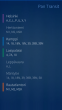
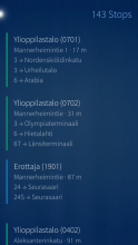
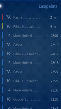
Pan Transit
Pan Transit is an application for Sailfish OS to view departures from public transport stops. It is designed to support multiple different providers (i.e. cities/regions). Currently supported are Helsinki Region Transport (HSL), Finnish Transport Agency, Transport for London and ASEAG in Aachen, Germany.
The dynamic plugin architecture should make it fairly easy for anyone with basic Python programming skills to add support for a new region. Providers only need to make API calls and transform that data to a format that Pan Transit understands and can display in its standard UI. Documentation is available at GitHub.
Please note that I do not plan to write providers for different regions myself, but will review and accept contributions from the community. Also, moderate suggestions to generalise the UI will be considered, but for very particular use cases, you might still be better of writing your own stand-alone app.
Source code and issue tracker are available at GitHub. Translations at Transifex. Discussion at TMO.
Donations appreciated: paypal.me/otsaloma
Category:
| Attachment | Size | Date |
|---|---|---|
| 83.51 KB | 05/12/2017 - 00:45 | |
| 85.97 KB | 18/02/2018 - 20:34 | |
| 87.1 KB | 12/06/2018 - 22:33 |


Comments
Ingvix
Tue, 2017/10/17 - 11:03
Permalink
I wonder if it'd be too much work to create system where you could insert a starting address and destination address which aren't necessary a bus stops and then the app could suggest transit plans from start point's nearest stops to nearest at the destination points and estimated travel times?
otsaloma
Tue, 2017/10/17 - 20:11
Permalink
I see Pan Transit mostly as an app for people who know where they're going and how, e.g. on a regular commute, but need to see the schedules. It would be nice to have routing in the same app, but it would also be a lot of work to add and it would just duplicate a lot of the stuff we already have in Poor Maps. There is a Finnish public transport router included in Poor Maps (see the 6th screenshot) and more can be added.
https://openrepos.net/content/otsaloma/poor-maps
Ingvix
Thu, 2017/10/19 - 11:10
Permalink
Thanks for informing me about that. I wasn't aware it had that kind of functionality.
bomo
Sun, 2017/09/24 - 19:54
Permalink
Dear otsaloma,
I am currently working on a provider for pan transit but have some issues with setting it up. As you wrote in the README on github, I debugged the code using on my PC using the python scripts (where it gives correct results, IMHO). However, after copying the files to "/home/nemo/.local/share/harbour-pan-transit/providers" and selecting the new provider in the settings the search is not given results.
Is there a way to debug this from within the app? What steps would you recommend?
Thanks!
otsaloma
Sun, 2017/09/24 - 20:49
Permalink
I'd recommend you clone the pan-transit code to the device, copy your providers there under the "providers" directory and at the source root launch the app with "qmlscene qml/pan-transit.qml". If there are some actual errors you should see some console output of them. If not, you'll need to add console.log or print calls in the code to see what happens, e.g. if looking for stops, then
Or, if you put your code on GitHub or something, I can take a look at it and test. You're probably the first one apart from me writing a provider, so there might be some issues with the API or documentation, and I'd be glad to fix them.
simosagi
Thu, 2017/03/02 - 13:08
Permalink
As I noticed on my phone it takes a while until the 'Nearby' option is active (probably because the device has first to find accurate GPS positioning) would it be possible to have a visual indication of that on the main screen, via e.g. a glowing dot on top of the screen or perhaps by glowing the menu 'pulling handle' ?
Otherwise it gets a bit annoying to pull down the menu again and again, only to find that the option is not yet active.
(BTW: I'm using with the HSL service)
Thanks
otsaloma
Thu, 2017/03/02 - 22:17
Permalink
A good idea, I'll add it for the next version.
I have set the requirement quite low, once the positioning accuracy is less than 1000 meters, the Nearby menu item is available. In my normal use, that level of accuracy is available almost instantly, but it of course depends on whether you have AGPS enabled or not and might even vary by device.
Yeum
Sun, 2018/03/04 - 19:05
Permalink
I don't recall when exactly it changed, but for some reason on the newest version takes quite a while (20-30 seconds?) before the "nearby" becomes available on my Xperia X. Previously the wait was maybe 5 seconds, tops.
otsaloma
Sun, 2018/03/04 - 19:16
Permalink
Did you have a different device before? For me, it was much faster on Jolla 1.